
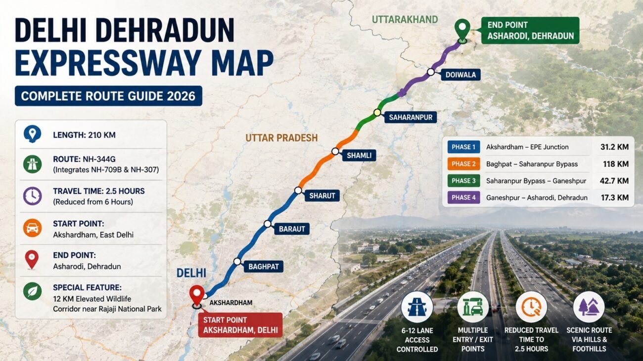
The Delhi Dehradun Expressway Map has become one of the most searched infrastructure references in North India. Prime Minister Narendra Modi inaugurated the expressway on 14 April 2026. This 210 km corridor now connects Delhi with Dehradun in just 2.5 hours. Anyone planning a road trip or checking property value along this route needs the Delhi Dehradun Expressway Map handy.
This guide explains the complete route, entry exit points, village list, and route number. It also covers the Akshardham to Dehradun Expressway route in detail. Read on to understand every section of the Delhi Dehradun Expressway Map before your next journey.
What the Delhi Dehradun Expressway Map Shows
The Delhi Dehradun Expressway Map traces a six lane, access controlled highway. It starts at Akshardham in East Delhi. It ends at Asharodi, near Dehradun in Uttarakhand. The corridor passes through Uttar Pradesh districts including Baghpat, Baraut, Shamli, and Saharanpur.
NHAI built this expressway under the Bharatmala Pariyojana scheme. The Delhi Dehradun Expressway Map reduces the old 250 km NH-58 route to just 210 km. This shortens travel time from six hours to 2.5 hours.
The Delhi Dehradun Expressway Map is divided into four phases. Each phase connects a different stretch of the corridor. Together, they form one continuous highway from Delhi to Dehradun.
Delhi Dehradun Expressway Route Number
Many travellers search for the exact Delhi Dehradun Expressway route number before planning their trip. The expressway carries the number NH-344G. It also integrates parts of NH-709B and NH-307 along different stretches.
The Delhi Dehradun Expressway Map marks NH-709B near the Akshardham and Delhi-Meerut Expressway junction. Further ahead, the route number shifts to NH-344G through Baghpat, Shamli, and Saharanpur. This numbering helps drivers identify the correct highway signage during the journey.
Knowing the Delhi Dehradun Expressway route number also helps property buyers verify location details in official land records and NHAI documents.
Delhi Dehradun Expressway Entry Exit Points Map
The Delhi Dehradun Expressway entry exit points map is essential for daily commuters. The expressway has multiple entry and exit points across its 210 km stretch. NHAI data confirms 16 entry and exit points on the full corridor.
In Delhi, the major entry points on the Delhi Dehradun Expressway Map include Akshardham, Gandhi Nagar-Geeta Colony, ISBT-Dilshad Garden Marg, Khajuri Pusta Marg, and Signature Bridge. These five points give commuters direct access from different parts of East Delhi.
Moving further, the Delhi Dehradun Expressway entry exit points map shows access at Loni and Mandola near the Ghaziabad-Baghpat border. Shamli Road offers an exit near Muzaffarnagar. Saharanpur Bypass provides another major junction point.
Near the final stretch, Asharodi serves as the primary exit for Dehradun city. Travellers heading to Mussoorie can continue on the Mussoorie Road spur from this exit. Those heading to Rishikesh should take the Ganeshpur exit and connect via NH-58.
This entry exit points map on the Delhi Dehradun Expressway Map makes trip planning simple. Drivers can choose the nearest access point based on their starting location.
Akshardham to Dehradun Expressway Route
The Akshardham to Dehradun Expressway route forms the backbone of the entire corridor. It begins at the Akshardham interchange in East Delhi. The Delhi Dehradun Expressway Map shows this starting point connecting directly with the Delhi-Meerut Expressway.
From Akshardham, the Akshardham to Dehradun Expressway route runs through an elevated section up to Khajuri Khas. This elevated stretch helps avoid congestion in dense Delhi neighbourhoods. The route then crosses the Delhi-UP border near Loni.
The Akshardham to Dehradun Expressway route continues through Baghpat, bypassing Baraut and Shamli. This greenfield stretch runs parallel to the older NH-709B alignment. It significantly reduces travel time compared to the earlier road network.
Further along the Delhi Dehradun Expressway Map, the Akshardham to Dehradun Expressway route reaches the Saharanpur Bypass. From here, it continues toward Ganeshpur near the Shivalik foothills. The final stretch includes twin tunnels and an elevated wildlife corridor before reaching Dehradun.
This complete Akshardham to Dehradun Expressway route spans 210 km. It replaces the older, more congested route that took nearly six hours to travel.
Delhi Dehradun Expressway Village List
The Delhi Dehradun Expressway village list helps residents and property seekers identify locations along the corridor. Several villages fall directly on or near the expressway alignment.
In Phase 2, the Delhi Dehradun Expressway village list includes Lohadda village near the Eastern Peripheral Expressway junction. Karaunda Mahajan village marks another key point along this stretch. Khyawari village lies further along before the road reaches Saharanpur Bypass.
Other villages appearing on the Delhi Dehradun Expressway village list include those near Baraut, Shamli, and Biharigarh. Biharigarh connects Phase 3 to Ganeshpur in Uttarakhand.
This village list matters for real estate buyers. Land near these villages has seen rising interest due to improved connectivity shown on the Delhi Dehradun Expressway Map. Investors often check this village list before finalising plots near the Delhi Dehradun Expressway corridor.
Delhi Dehradun Expressway Map: Phase Wise Breakdown
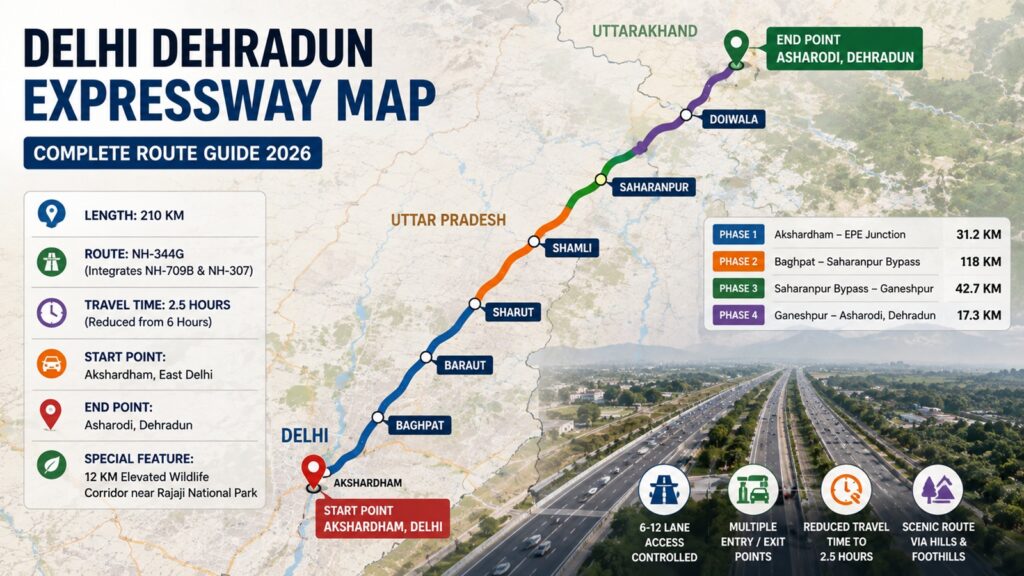
Understanding each phase makes the Delhi Dehradun Expressway Map easier to follow.
Phase 1 covers Akshardham to the Eastern Peripheral Expressway junction near Khekra. This 31.2 km stretch lies mostly within Delhi and Baghpat district. It includes an elevated section and multiple entry exit points.
Phase 2 spans 118 km from Baghpat to Saharanpur Bypass. This greenfield section bypasses Baraut and Shamli towns. It runs through four separate construction packages, each covering a distinct stretch of villages.
Phase 3 connects Saharanpur Bypass to Ganeshpur, covering 40 km. This section involves brownfield development, upgrading existing highway infrastructure with new service lanes.
Phase 4 completes the Delhi Dehradun Expressway Map with the final stretch from Ganeshpur to Dehradun. This section features twin tunnels, an elevated flyover, and the famous wildlife corridor near Rajaji National Park.
Distance and Travel Time on the Map
The Delhi Dehradun Expressway Map confirms a total distance of 210 km. This is shorter than the earlier 250 km route via NH-58. Average travel time has dropped from six hours to around 2.5 hours.
Speed limits on the expressway reach up to 100 km per hour on most stretches. The Delhi Dehradun Expressway Map recommends caution near the wildlife corridor section, even though official limits remain unchanged there.
Read More: Delhi Dehradun Expressway
Key Features Marked on the Delhi Dehradun Expressway Map
The Delhi Dehradun Expressway Map highlights several engineering features. These include 113 vehicular underpasses and five railway overbridges. The corridor also has 76 km of service roads and 29 km of elevated sections.
A standout feature on the Delhi Dehradun Expressway Map is the 12 km elevated wildlife corridor. This section protects Rajaji National Park wildlife, including elephant herds. Two dedicated 200 metre underpasses allow safe elephant movement beneath the highway.
The map also shows a 340 metre tunnel near Dal Kali Temple. This tunnel avoids disturbing the surrounding wildlife sanctuary. Noise barrier devices along forest stretches reduce disturbance to animals further.
Why the Delhi Dehradun Expressway Map Matters for Property Buyers
Real estate demand has risen sharply along the Delhi Dehradun Expressway Map corridor. Improved connectivity has boosted interest in Baghpat, Shamli, and Saharanpur locations. Properties near expressway entry exit points often command higher value.
Buyers should study the Delhi Dehradun Expressway Map before investing near this corridor. Proximity to entry exit points and village list locations often influences long term appreciation. The map also helps buyers verify road connectivity claims made by developers.
Conclusion
The Delhi Dehradun Expressway Map has transformed connectivity between Delhi and Uttarakhand. It reduces travel time significantly while offering multiple entry exit points across its 210 km stretch. Understanding the route number, village list, and Akshardham to Dehradun Expressway route helps travellers and investors alike.
Whether you are planning a weekend trip or checking real estate potential, the Delhi Dehradun Expressway Map remains an essential reference. Keep this guide handy for accurate route planning on your next journey.
Frequently Asked Questions
1. What is the total length shown on the Delhi Dehradun Expressway Map?
The Delhi Dehradun Expressway Map shows a total length of 210 km, connecting Akshardham in Delhi to Dehradun in Uttarakhand.
2. What is the Delhi Dehradun Expressway route number?
The expressway carries route number NH-344G, along with connecting stretches of NH-709B and NH-307.
3. How many entry exit points does the expressway have?
The Delhi Dehradun Expressway entry exit points map shows 16 total access points across the full corridor.
4. Which villages fall along the Delhi Dehradun Expressway route?
The Delhi Dehradun Expressway village list includes Lohadda, Karaunda Mahajan, Khyawari, and Biharigarh, among other locations near Baghpat and Saharanpur.
